

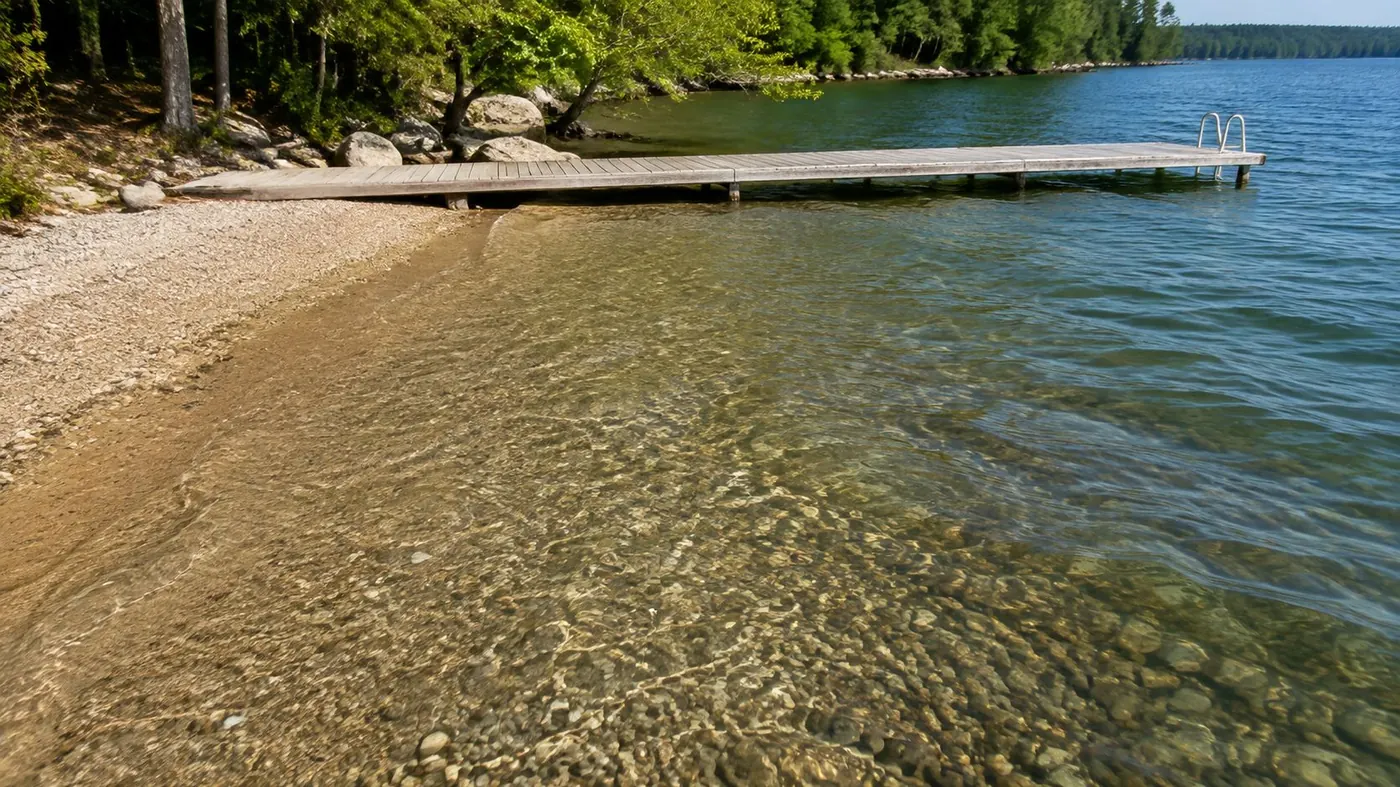
Two Lake Couchiching waterfront homes can sit side by side, carry identical frontage on paper, and still be worth meaningfully different amounts. That is not a quirk of Orillia. It is the defining feature of waterfront, and it is why pricing a lake property is a different discipline from pricing an in town home a few streets away. The value sits in a narrow strip of land and water that almost nothing in the listing data actually describes.
The value of a Lake Couchiching waterfront property is driven far more by the usable qualities of its shoreline than by the size of the house. Frontage measured at the water, depth at the dock, shoreline type, exposure, elevation and steps, dock and boathouse status, whether the original shore road allowance has been closed and conveyed, septic location relative to the lake, flood and erosion mapping, and year round road access all move value independently. Because few properties sell on any one lake, and each is a different combination of those attributes, comparable selection carries most of the analytical weight. Price per foot rules and automated valuation models both miss what matters most.
Why is pricing waterfront different from pricing an in town home?
An in town home sits inside a population of similar homes. Same era, similar lots, similar services, and enough recent transactions that a careful comparison narrows quickly. The attributes that vary are mostly inside the building, and buyers price them in familiar ways.
Waterfront inverts that. The land is not interchangeable, the sales are few, and the attributes that matter most are outdoors, physical, and often invisible in photographs. Water depth cannot be seen from the road. Shoreline type cannot be judged from a listing description. A steep bank looks like a view in one photograph and like forty steps in another.
So a waterfront analysis spends most of its effort on the site rather than on the house, and much of what it produces has to be reasoned rather than looked up. That is worth naming plainly, because it is also the part of the work that a seller is entitled to see explained.
What the shoreline itself is worth: frontage, depth and exposure
Frontage is measured at the water, not at the road. On an irregular lot those numbers can differ substantially, and where an original shore road allowance still sits between the deeded parcel and the lake, the lot may not legally touch the water at all. Frontage also gates what can be built, since shoreline municipalities commonly tie permitted structure width and boathouse permissions to measured water frontage. Confirm the rules with the municipality the property sits in.
Depth at the dock decides whether a boat lives here. Boatable depth close in supports a different use, and a different buyer, than a bottom that stays shin deep for thirty metres. Depth also determines which docks are feasible at all: the Department of Fisheries and Oceans dock primer notes that a floating dock needs roughly three feet of water to sit properly (Fisheries and Oceans Canada, n.d.).
Shoreline type is close to a fixed attribute. Sand supports swimming and small children. Clean rock gives deep entry and low maintenance. Shale can be slippery. Weedy shallows limit swimming and boating, and an owner cannot simply landscape them away, because Lake Couchiching is part of the Trent-Severn Waterway, where Parks Canada requires a permit for shoreline stabilization and the removal of aquatic vegetation, alongside any municipal approvals.
Exposure is a preference, not a ranking. A west facing shore takes the afternoon sun and the sunset, and also the prevailing wind and the wave fetch that comes with it. An east facing shore gets calm mornings and sunrise, with shade by evening. Neither is better, but wind exposure has real consequences for shoreline protection and dock design.
The rest of the value: land, structures and title
Elevation and steps. A high bank buys view, breeze and distance from high water. It also buys stairs, and for many buyers the number of steps between the kitchen and the dock is a constraint rather than a detail.
Privacy and sight lines. How close the neighbours sit, whether the lot is on a point or tucked into a bay, and whether their docks cut across the view all shape how the property feels from the deck.
Dock and boathouse. Type, condition, and whether the dock comes out for winter all matter. Floating and pipe docks are usually pulled each season, cribs can be toppled by shifting ice, and driven piles can be lifted by ice movement (Fisheries and Oceans Canada, n.d.). The dock primer is blunt that spring ice destroys almost anything left in the water, and how docks are maintained and taken out on Lake Simcoe applies directly here. A legally established boathouse carries weight because current rules make new ones difficult.
The shore road allowance. An original allowance, historically laid out at sixty-six feet, stays municipally owned until a by-law closes it and it is conveyed (Government of Ontario, 2026). Ontario's municipal road allowance policy acknowledges that structures built on these strips have created complications with property transfers and mortgages (Government of Ontario, 2026). See how shore road allowances work and why they are closed and conveyed.
Servicing, hazard and access. Where the septic sits relative to the lake, whether the property falls inside mapped flood and erosion hazard areas, and whether the road is maintained through winter all move value. CMHC's second home product requires year round vehicular access and suitability for full time occupancy, which is why what makes a cottage genuinely four season is a pricing question (Canada Mortgage and Housing Corporation, n.d.).
Why do automated valuations and price per foot rules mislead on waterfront?
Automated valuation models work by finding patterns across large numbers of comparable transactions. That works reasonably well in a subdivision of similar houses. On a lake the sample is small and every property is a different bundle of attributes, so the model has too few observations and no data on the variables that carry the value. It cannot see depth at the dock, shoreline type, the step count, or whether the shore road allowance was ever closed.
Price per foot fails for a related reason. It assumes value rises in a straight line with frontage and that every foot is equivalent. A hundred feet of deep water sand with a level walk out is not the same asset as a hundred feet of weedy shallows below a steep bank, and no single multiplier reconciles them.
There is a data problem underneath both. Frontage figures in listing records are sometimes measured at the road, sometimes carried forward from an old description, and sometimes approximate. A wrong input cannot be rescued by arithmetic afterward, which is why how an Orillia home valuation is put together matters more on the water than anywhere else.
Why comparable selection is the hardest part on a lake
Here is the honest version. On a given stretch of shoreline in a given period, the number of arm's length sales that genuinely resemble a subject property is often very small. That forces a choice nobody enjoys: a recent sale that is not very similar, or a similar sale that is not very recent. Both require adjustment, and every adjustment has to be defensible and disclosed.
The attributes also refuse to vary independently. Deep water tends to come with rock, rock with elevation, and elevation with steps and a better view. Clean pairs of sales that isolate one variable are rare, so the analysis has to reason across several at once. This is where a REALTOR®'s judgment genuinely earns its keep, and it is more honest to say so than to claim the process is mechanical.
When Kimberly prepares a waterfront valuation, she measures frontage at the water rather than at the road and reads the parcel register before looking at a comparable sale, because a title question can change which sales are comparable at all.
Lake Couchiching, the Narrows and which side you are on
Lake Couchiching sits immediately north of Lake Simcoe and connects to it through the Narrows at Orillia (Parks Canada, n.d.). It forms part of the Trent Severn Waterway, so a boat can leave the lake through the lock system rather than being confined to one body of water (Parks Canada, n.d.; Township of Severn, n.d.). That connectivity is a genuine attribute.
Location on the lake matters. The southwestern shore is Orillia, close to downtown, the parks and the hospital, with municipal servicing in many areas, while the shore farther north, including Westshore, falls within the Township of Severn. The eastern shore falls within the Township of Ramara, and the northern end at Washago within the Township of Severn; both are more rural, more often on private well and septic, and different again in zoning and permitting. Be clear about which municipality governs the property, because that changes who issues permits and what can be built.
The lake carries a real mix of year round homes and seasonal cottages, sometimes on the same road. That widens the buyer pool but complicates comparison, since the two are not interchangeable in financing, insurance or use. Where a property sits between seasonal and year round, and on the difference between waterfront and water view, is part of what the pricing work resolves.
What to gather before a waterfront pricing conversation
- The survey or Surveyor's Real Property Report, and any reference plan describing the shore road allowance parts.
- The parcel register, so shore road allowance status is confirmed rather than assumed.
- The sewage system permit and pumping records, and the well record if the property is on a private well.
- Permits and approvals for the dock, boathouse, shoreline work and any additions (Parks Canada, 2026).
- Conservation authority correspondence, and confirmation of how the property is mapped for flood and erosion hazard.
- Road details: who owns it, who maintains it, and whether it is plowed through the winter.
- Photographs across seasons and water levels, including the shoreline itself rather than only the view.
Gathering this before listing rather than during due diligence tends to make the process calmer, and it fits naturally into the full home selling timeline in Ontario.
Common questions
Why is price per foot of frontage a poor way to value waterfront?
A price per foot figure assumes value rises in a straight line with frontage and that every foot of shoreline is worth the same. Neither assumption holds on a lake, because depth at the dock, shoreline type, exposure, elevation and title status change what those feet can actually be used for. Two properties with the same measured frontage can differ substantially in usable value.
Does an unclosed shore road allowance affect a waterfront property's value?
It can affect marketability. An original shore road allowance is a separate strip of land that stays owned by the municipality until a by-law closes it and it is conveyed to the abutting owner. Where it is unclosed, the dock, stairs or boathouse in front of the cottage may stand on municipal land rather than on the owner's land. Ontario's road allowance policy acknowledges that this pattern has created complications with property transfers and mortgages, and a real estate lawyer reading the parcel register is the person who confirms the status.
Why do online home valuation tools struggle with waterfront properties?
Automated valuation models find statistical patterns across large numbers of similar transactions. A single lake produces few sales, and those properties vary widely in attributes the model cannot see: water depth at the dock, whether the shoreline is sand or weedy shallows, how many steps run down to the water, and whether the shore road allowance has been closed and conveyed. With few observations and missing variables, the output is an estimate built on the wrong inputs.
Talking it through before you list
Waterfront pricing rewards patience with the details, because the details are where the value actually lives. The most useful conversation a Lake Couchiching owner can have starts with the shoreline, the survey and the paperwork, well before anyone talks about a number.
If you own on Couchiching and want to understand how your stretch of shoreline compares, book a time to talk it through. Bring the survey if you have one, and bring your questions.